

The greater Phoenix area which includes the East Valley is the shangri la for golfers with public and private courses at every turn. We’re also a paradise for the avid or casual hiker, biker* and horseback rider with miles and miles of trails extending in every direction.
The Biodiversity of the Desert
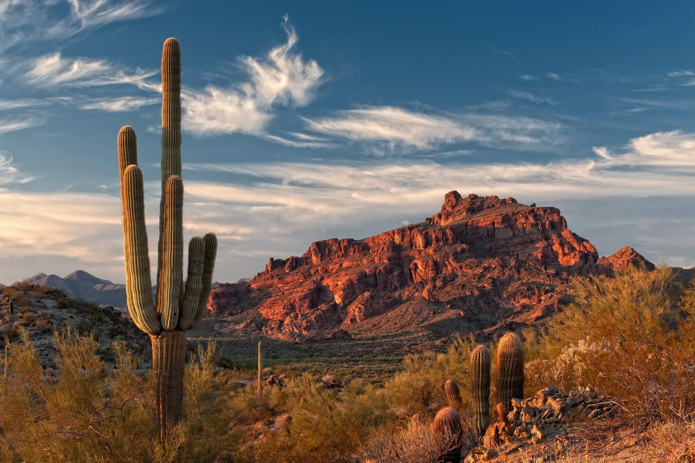
You might envision only flat terrain because our home is a desert. The Sonoran Desert, however, is strikingly diverse in geological structures: we have mountains that will take your breath away both in challenging climbs and magnificent vistas! Our myriad of trails accommodate and challenge all skill levels and include exciting topography and ascending elevations.
I’ve hiked some of the trails included in this blog. The scenery, vegetation and wildlife are especially rewarding, no matter the altitude or time of year. Most days you need a hat, sunscreen, sunglasses and sturdy shoes. Winter months may dictate a sweatshirt or warm jacket and hat. For all seasons, a camera, binoculars and field guides are essential items in my day pack.
Be Safe and Comfortable
Subtropical deserts such as the Sonoran Desert are ecosystems characterized by high temperatures and very low annual precipitation. Checking the weather in advance of your leg work is much advised since our typically warm temperatures can be extreme and should not be underestimated. Keep in mind that trail difficulty levels are raised one level when temps are greater than 100℉. Dogs are not permitted on the City of Phoenix hiking trails when the temperature reaches 100 degrees or higher.
Subscribe to safety and take our heat seriously! Unless you’re a roadrunner, it’s critical to hydrate before you go, carry enough water to stay hydrated and hydrate upon your return. Always carry more water than you expect to need. Snacks are important, too.
The Sonoran Desert receives 3-15 inches of rain annually. This most often occurs in our monsoon season, July through September. During those times a lightweight rain jacket may be prudent. Our monsoon season is also the time to be alert for flash floods and mudslides caused by torrential rain on land that is impermeable to water. Be aware of your surroundings and particularly of dry washes which can fill with fast moving water in a matter of minutes.
Other safety tips include formulating a plan, informing someone of your plan before you go, traveling with others and remaining alert to wildlife. Taking a first aid kit and a fully charged cell phone are also wise choices.
Please and Thank You
More than 100 reptiles, 2000 native plants, 60 mammals and 350 birds call our desert home, thriving only if the habitat is maintained. Please minimize your footprint and leave no trace by:
- Staying on trails
- Respecting wildlife
- Not altering the landscape
- Taking all trash with you

You’re Off to Great Places
I’ve organized this list of parks and preserves under the nearest city. If you consider yourself to be more of a “walker” instead of a hiker you will also find information on stellar walks where you can view native plants, wildlife and captivating scenery. Links are included to provide the trail details you need: level of difficulty, unique characteristics of trails and crucial maps. Some of the links offer information about all of the trails, parks and preserves included in this blog. The variety in links is not to confuse you but to help you find what you need in a preferred format. At the end are several of Arizona Vacation Home Rentals’ properties that are either adjacent to or a short commute to trails.
Mesa
The Hawes Trail System in NE Mesa consists of well marked, single lane biking and moderate hiking trails that intersect and form loops. There is a map at the trailhead on N Power Road/N Bush Highway in Las Sendas which you can use to design your own course for the desired distance. Views of Usery Mountain, Red Mountain, the Salt River and Granite Reef Dam are all possibilities.
Usery Mountain Regional Park has 29 miles of multi-use trails for hikers, bikers and horseback riders with a staging area for horses. Trails range in difficulty and distance and provide spectacular views of the surrounding plains. The popular Wind Cave Trail allows hikers to climb up into the mountain and connect to trails in the Tonto National Forest.
The Lower Salt River Nature Trail offers a leisurely 2.5 mile loop along the appealing Salt River. Access and parking is on Phon D Sutton Road off of the N Bush Highway. This nature walk promises wildlife sightings of horses, wading birds, deer and more.
Boulder Canyon Trail is northwest of Mesa near Tortilla Flat and offers an 8.7 mile out and back jaunt for the more experienced hiker. The trail starts at and returns to Sagaro Lake and provides worthwhile views of Battleship Mountain and other splendid Superstition Mountain scenery.
Rio Salado Pathway, also known as Tempe Town Lake Trail, is comprised of two distinct trails on either side of the Salt River. Trail riders may choose to continue on the trail north of the river all the way to downtown Scottsdale. Access to the Rio Salado Paths are at Riverview Park in Mesa and Tempe Beach Park in Tempe.
Dreamland Villa Desert Nature Walk is a one mile strip that by design features native vegetation for the purpose of attracting wildlife. This walk is intended for hikers; bikes are not permitted on all sections. Longer hikes are possible by using available maps and directions.
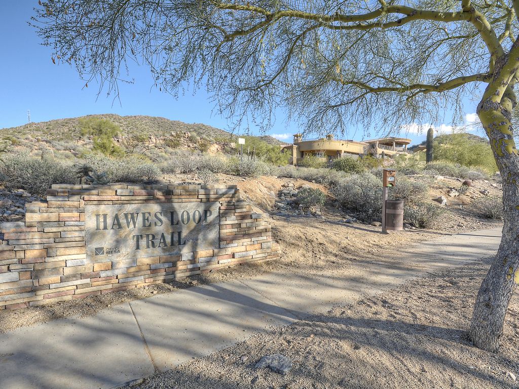
Hawes Loop Trail System
Scottsdale
McDowell Sonoran Preserve features three trails that were created to be accessible to individuals of all ages, including those who use wheelchairs for mobility and are hearing and/or visually impaired. Along the way are interactive displays with a universal design to educate people with a wide range of abilities about the surrounding ecosystem.The McDowell Sonoran Preserve Trailheads are organized by north and south regions. The amenities and skill levels are different for each one. Several trailheads provide places for loading and unloading horses.
McDowell Mountain Regional Park is northeast of Scottsdale and has more than 40 miles of hiking, biking and riding trails. Trails range from easy to difficult and .5 to 15+ miles in distance. Trails are multi-use unless designated otherwise. There are staging areas for horses.
Pinnacle Peak Park has a moderate out and back 3.5 mile trail with the highest point on the peak at 2,889 feet. There are also rock climbing routes and interpretive displays along the way. Bikes and dogs are not permitted on the trail.
Black Canyon Trail is 75+ miles of challenging off road trail connecting north Phoenix to the Prescott National Forest. This challenging trail is mostly used by mountain bike riders and runners. The trail winds through the Sonoran Desert and includes both saguaro forests and rocky canyons. Be alert to flash flood warnings as canyon washes in lower elevations may become dangerous in a few short minutes.
Gilbert
Riparian Preserve at Water Ranch is 110 acres of ponds and vegetative zones with 4.5 miles of easy walking, biking and horseback riding trails. Opportunities to view wildlife are promising with more than 295 bird species visiting throughout the year and fish, reptiles and amphibians making the preserve their home. Binoculars, cameras and field guides are highly recommended.
San Tan Mountain Regional Park is southeast of Gilbert and Chandler in Queen Creek. The more than 10,000 acre park includes trails that are well known for their diversity in wildflowers and native wildlife relative to the elevation. Goldmine Mountain stands high in the northern region of the park. Elevations range from 1,400 to almost 2,600 feet.
Phoenix
Phoenix Sonoran Preserve is north of the city and features 3 trailheads and over 36 miles of trails in mostly undeveloped desert. This preserve is a newer city venture to connect hikers and riders to the beautiful landscapes within the Valley.
Phoenix Mountains Preserve is just 20 minutes from downtown Phoenix and offers parks and peaks with miles and miles of trails for riders and hikers. The numerous trails range in difficulty and distance. This Phoenix City map provides a detailed overview of the parks and trails that are part of the preserve. Camelback Mountain is one of the most popular hikes in the Phoenix Mountains Preserve and features two challenging trails with steady climbs: Echo Canyon Trail and Cholla Trail. Plant and animal species are prolific on both climbs. Expect spectacular 360° city and desert views from the top of the summit which resembles a camel’s hump.
South Mountain Park and Preserve is a large municipal park with more than 58 miles of hiking, biking and horseback riding trails for all skill levels. There are several places to access the park, depending on the trails(s) you are interested in exploring. Anticipate spectacular mountain views when you reach the mountain tops. Looking for an escape from motor vehicle traffic? Check out Silent Sunday in which the park’s main road is closed to motor vehicle traffic but open to non-motorized activities such as walking, cycling, jogging and hiking.
Papago Park offers miles of trails that are easy for walking or biking with little climb in elevation. The park is split by the Galvin Parkway into east and west sections. There are appealing trails in both sections with impressive views of Phoenix and Tempe from some unique vistas. Nearby attractions include the Phoenix Zoo, Desert Botanical Garden, Arizona Heritage Center and the Papago Golf Club.
Lost Dutchman State Park is 40 miles east of Phoenix and contains trails suitable for beginners to more advanced hikers. The trails wind through the Superstition Mountains making appropriate footwear, suitable gear and adequate hydration critical.
Payson (90 minutes north of the East Valley)
The Mogollon Rim near Payson offers amazing views as you hike through lush deciduous and pine forests and along lakes, springs, rivers and waterfalls. Trails range in levels and distance; rim views encompass hundreds of miles. Expect cool to cold temperatures and prepare accordingly. Waterproof footwear and gear is highly recommended.
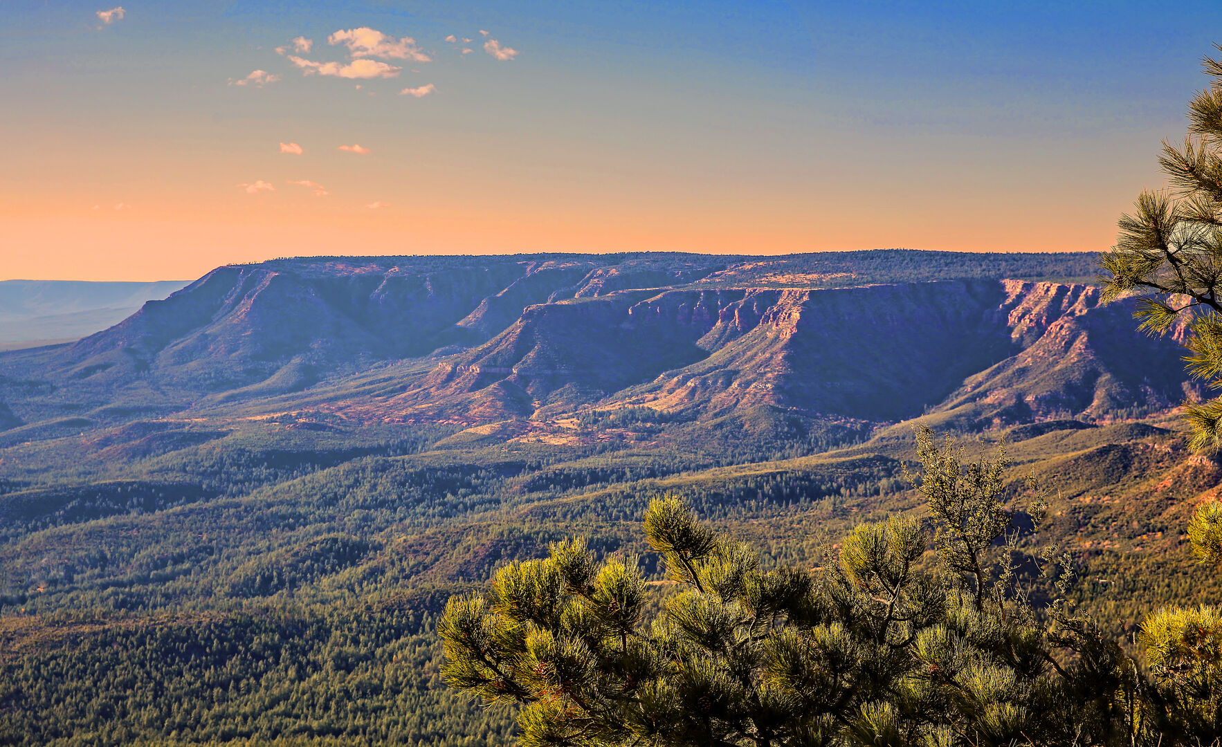
Mogollon Rim
Arizona Vacation Home Rentals has several homes with trails adjacent to the property or community:
- Diamond Spirit Ranch in Payson connects to Tonto National Forest trails.
- Gold Canyon Retreat in Mesa has Superstition Mountain trails behind the home.
- Gold Canyon Trails in Mesa has a path that leads to the Hieroglyphic Trail in the Superstition Mountains.
- The Castle Resort in Mesa has hiking and biking trails that border Usery Mountain Regional Park in front of the home.
- Valley Vista in the San Tan Mountains is a short drive to San Tan Mountain Regional Park in Queen Creek.
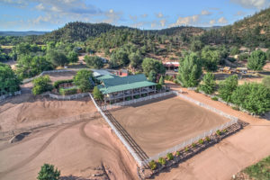
Diamond Spirit Ranch
Save money and support local business by booking directly through
Arizona Vacation Home Rentals
Phone/Text: 480.626.4072
*This article is intended to serve the interests of non-motorized bikers only. Guests will need to read trail and park details to locate ones that permit motorized bikes.
By providing links to other sites, AVHR does not guarantee, approve, or endorse information or products available on these sites.